Version 1 - Superseded Planning Scheme
- Citation and commencement
- Part 1 About the planning scheme
- Part 2 State planning provisions
- Part 3 Strategic framework
- Part 4 Local Government Infrastructure Plan (LGIP)
- Part 5 Tables of assessment
- Part 6 Zones
- Part 7 Local plans
- Part 8 Overlays
- Part 9 Development codes
- Part 10 Other plans
- Schedule 1 Definitions
- Schedule 2 Mapping
- Schedule 3 Local Government Infrastructure Plan (LGIP) mapping and tables
- Schedule 4 Notations required under the Sustainable Planning Act 2009
- Schedule 5 Land designated for community infrastructure
- Schedule 6 Planning scheme policies
- Appendices
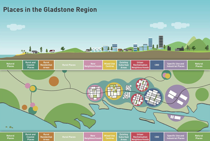
The Gladstone Region Places Model
A central aspect of this strategic framework is the Gladstone Region places model. The region can be thought of as a series of places, each with their own preferred character and function. This model describes this through place types throughout the Gladstone region. These place types are expressed in greater detail within the themes in the strategic framework and throughout the rest of the planning scheme.